

In our previous post, we learned about sensors and the autonomous vehicle. Next, we’ll dive deeper into the use of RADARs.
Mapping Distances and Angles
Active sensors, on the other hand, rely on a self-generated signal that is used to illuminate the environment around them. You would be able to locate a bat in the same dark, silent room because the bat uses echolocation to figure out where it is in the dark. The bat makes clicking noises with its mouth that come back as echoes that tell the bat the location of objects around it.
Before we get on to RADAR, let’s have a quick look at a much simpler device: the electronic tape measure. The tape measure uses a similar approach to that of the bat. An ultrasonic transducer emits a short pulse of high frequency sound that travels through the air and bounces off an object such as a wall, back to the transducer which is used to receive it. Because the speed of sound through air is reasonably constant, the time taken for an echo to come back can be used to calculate the distance to the object. In the case of the tape measure, the sensor only measures distance. There is not enough information to determine direction. The reversing sensors in your car also use this type of ultrasonic distance sensor. RADAR works in a similar fashion, but with some important differences.
Determining Positions Over Long Distances
With a few exceptions, modern RADAR systems generally don’t work quite like the original WWII English version. Instead of separate transmitter and receiver antennas, the transmitter and receiver both use the same antenna, which is moved to scan the area of interest. A RADAR antenna has a very narrow sensitive zone, or “beam,” which means that the direction of a reflected wave can be accurately determined. The RADAR systems at airports are of this type. You could think of a rotating antenna RADAR as being a bit like a searchlight beam sweeping around a dark landscape. You can only see those things that are illuminated by the beam.
3D RADAR systems use a similar concept, but a different means of achieving it. Instead of moving the antenna, the antenna is of a special type called a “synthetic aperture” antenna that, with some sophisticated signal processing, can move the beam around without moving the antenna. The beam is then scanned using software. These RADAR systems can determine the direction in both bearing (the left/right plane) and elevation (altitude) as well as distance.
Another different type of RADAR uses the Doppler effect. When an object is moving towards or away from a transmitter, the reflected wave returns to the receiver shifted slightly in frequency. An object coming towards the transceiver will give an echo that is slightly higher in frequency and an object that is moving away will give an echo that is slightly lower in frequency. The frequency difference, or shift, is directly related to the speed with which the object is moving relative to the transceiver.
The radar guns that we all know and love used by police to measure speed use Doppler RADAR. A highly sophisticated 3D search RADAR such as those used by the Military combines all of these techniques and more with some very sophisticated processing to give a system that can tell the size, distance speed and direction of travel of aircraft and other vehicles in their vicinity.
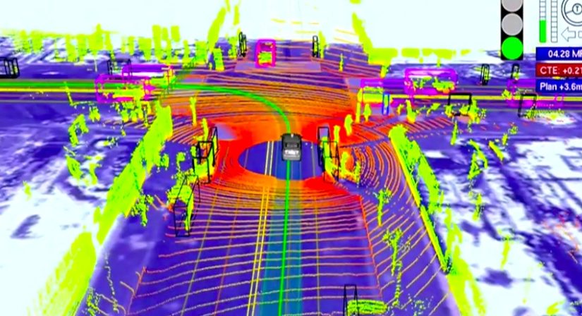
Lots of RADARS in Autonomous Vehicles
RADAR sensors are good for detecting objects that are close and moving quickly (such as curbs, other cars and pedestrians), although the type in the Google car are not that good at measuring direction. The Google car has 4 bumper mounted RADAR sensors that are more like the electronic tape measure I mentioned earlier. This type of RADAR is also used to help aircraft pilots avoid collisions with terrain. Used in this way it is called a RADAR altimeter, and it works by bouncing radio waves off the ground to figure out how far the ground is away from the aircraft. If the aircraft gets too low, a terrain warning is sounded in the cockpit.
In a similar way, the Google car is able to tell if it is getting too close to the cars in front of it, and is able to detect objects such as pedestrians that appear in its path. By using Doppler, the RADAR sensors are able to tell if the car in front has changed its speed — by braking sharply, for example.
Google used a modified Toyota Prius as the basis for their Google car prototypes. If you look at the pictures of the early prototype Google cars you can see two of the RADAR units just in front of the left and right mirrors. They aren’t very big, maybe 7-10cm on a side. The reason that modern RADARS are so small is that they use very high frequency radio waves in the microwave spectrum. It might be a bit of a concern for some that there will be cars driving around radiating microwaves all over the place, but here is no need to be concerned. The power levels are very low – about the same as your home WiFi router or your mobile phone.

Comments are closed.